Auction
Price and date
Category
Autographs & Ephemera (40)
Books (245)
Collectables (1)
Decorative Prints (47)
Maps (84)
Your browser seems to have JavaScript disabled - please allow JavaScript in order to view lots on this page.
Lot 97 - England & Wales. Stockdale (John), Map of England & Wales..., 14th June 1809
Sold for £200
Lot 98 - England & Wales. Visscher (Nicolas), A New Mapp of the Kingdome of England...
Sold for £110
Lot 99 - England & Wales. Willdey (G.), The Roads of England According to Mr Ogilby's Survey, circa 1740
Sold for £400
Lot 100 - Folding Maps. A mixed collection of approximately 60 maps, 18th - 20th century
Sold for £750
Lot 101 - Geographical Game. Bowles (Carington), Bowles's British Geographical Amusement..., 1791
Sold for £420
Lot 102 - Geographical Game. Wallis (E. publisher), Wallis's New Railway Game..., circa 1845
Sold for £380
Lot 103 - Gloucestershire. Blaeu (Johannes), Glocestria Ducatus vulgo Glocestershire, Amsterdam, circa 1648
Sold for £220
Lot 104 - * Gloucestershire. Blaeu (Johannes). Glocestria Ducatus vulgo Glocestershire, circa 1648
Lot 105 - Hampshire & Dorset. A collection of five maps, mostly 18th & 19th century
Sold for £280
Lot 106 - Herefordshire. Jansson (Jan), Comitatus Herefordiensis, Herefordshire, circa 1640
Sold for £180
Lot 107 - * Herefordshire. Taylor (Isaac), ..., New Map of the County of Hereford..., 1754
Sold for £900
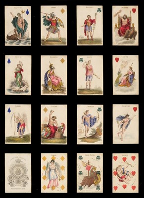
Lot 108 - * Hodges (Charles, publisher). Astronomical Playing Cards, London, c.1828
Sold for £2,600
Lot 109 - Hodges (Charles, publisher). Geographical playing cards, London, 1827
Sold for £3,400
Lot 110 - * Huntingdonshire. Blaeu (Johannes), Huntingdonensis Comitatus, Huntington shire, circa 1645
Sold for £120
Lot 111 - India. Gunter (Col. C. P. publisher), Calcutta & Howrah Guide Map, 1926
Lot 112 - Intourist (publishers). Three Soviet pictorial city and regional plans, 1935 - 38
Sold for £460
Lot 113 - Ireland. Mercator (Gerard), Ultoniae Orientalis pars 1595 or later
Sold for £160
Lot 114 - Italy. Mortier (Pierre), Bergamo Ville des Venitiens dans le Bergamasque...., 1700 - 24
Lot 115 - * Japan. Blaeu (Johannes), Japonia Regnum, Amsterdam, circa 1655
Lot 116 - * Japan. Briet (Philippe), Royaume du Japon designé par le Pere Ph: Briet..., Paris, circa 1660
Lot 117 - * Japan. Seutter (George Matthaus), Imperium Japonicum..., Augsburg, circa 1750
Sold for £650
Lot 118 - * Japan. Tirion (Isaac), Nieuwe Kaart van't Keizerryk Japan..., circa 1760
Lot 119 - * Japan. Tirion (Isaak), Carta Accurata Dell' Imperio del Giappone..., Venice, circa 1740
Sold for £130
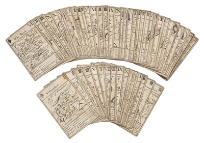
Lot 120 - Lenthall (John). A set of 49 (of 52) playing card maps and two explanation cards, circa 1717
Sold for £13,000
Lot 121 - Lenthall (John, publisher). Geographical Cards of England, with part of Scotland... [c.1712-1717]
Lot 122 - London. Gill (MacDonald), The Wonderground Map of London Town..., 1924
Sold for £1,200
Lot 123 - London. Kitchin (Thomas), A Pocket Plan of the Cities of London & Westminster..., 1773
Lot 124 - London. Laurie (Richard Holmes), Laurie's New Plan of London, and its Environs 1846
Sold for £800
Lot 125 - London. Lewis (Samuel). A Plan of London and its Environs Shewing the Boundaries ..., circa 1850
Sold for £1,500
Lot 126 - London. Rocque (John), An exact survey of the city's of London, Westminster..., 1741 [but 1878]
Sold for £340
Lot 127 - London. Wilme (B. P. W. surveyor). Wilme's Symbolic Map of London..., Baily Brothers, 1851
Lot 128 - Maps. A collection of 11 maps, 18th & 19th century
Sold for £560
Lot 129 - Maps. A collection of 5 maps, 17th & 18th century
Sold for £300
Lot 130 - Midland Counties. A collection of 42 maps, 17th - 19th century
Lot 131 - Military Maps. A collection of four maps and plans, 18th century
Lot 132 - Northern Counties. A collection of approximately 45 maps, 17th - 19th century
Lot 133 - Northumberland. Speed (John), Northumberland, John Sudbury & George Humble, 1611 or later
Sold for £240
Lot 134 - North-Western Counties. A collection of seven maps, 17th - 19th century
Estimated at £200 - £300
Lot 135 - Ogilby (John). A collection of six road maps, 1675 or later
Sold for £150
Lot 136 - Poland. A collection of 36 town and city plans, 17th - 19th century
Sold for £600
Lot 137 - * Poland. Von Pufendorf (Samuel), Auctior et Correctior Tabula Chorographica Regni Poloniae , 1696
Lot 138 - Prussia. Visscher (Nicolaus), Magnae Prussiae Ducatus Tabula..., Petrus Schenk Junior, 1750
Lot 139 - S.D.U.K. Maps of the Society for the Diffusion of Useful Knowledge, Volume I only, 1851
Lot 140 - Sayer (J. P.) 12 Original Prints..., Picture Maps of London, Strand Magazine, circa 1948
Sold for £360
Lot 141 - Scotland. Adair (John). The Frith of Forth..., 1703
Lot 142 - Scotland. Pont (T. / Blaeu J.), Coila Provincia..., & Caricta Borealis..., circa 1654
Sold for £100
Lot 143 - Sea Charts. Collins (Captain Greenville), Plymouth & The East Coast of England, circa 1700
Lot 144 - Shetland Islands. Van Keulen (Gerard), Het Eyland Hitland met zyn Onderhoorige Eylanden, 1728