Please enter your email address below, we will send you a notification email when the sale is available to view online.
Your browser seems to have JavaScript disabled - please allow JavaScript in order to view lots on this page.
Lot 218 - Lancashire. Greenwood (C. ), Map of the County Palatine of Lancaster...., 1818
Sold for £80
Lot 219 - * London. Booth (Charles), Untitled map of West London, circa 1890
Sold for £150
Lot 220 - * London. Meyer (Pieter). Platte Grond der Steden London en Westminster..., Amsterdam, 1760
Sold for £240
Lot 221 - London. Weller (Edward), London, circa 1863
Sold for £360
Lot 222 - Middle East. A collection of approximately 42 maps, 18th & 19th century
Sold for £160
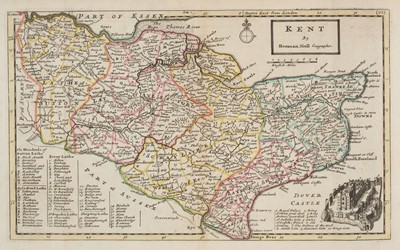
Lot 223 - Moll (Herman). H. Moll's British Atlas: or Pocket Maps of all the Counties..., 1753
Sold for £460
Lot 224 - New Zealand. Entrances to Manukau Harbour, 1853, Corrected to 1864
Sold for £120
Lot 225 - North America. Lodge (James), Chart and Plan of the Harbour of New York..., 1781
Sold for £380
Lot 226 - North West England. A collection of five maps, 17th & 18th century
Sold for £200
Lot 227 - * Northamptonshire. Blaeu (Johannes), Comitatus Northantonensis vernacule Northampton Shire, 1645
Estimated at £150 - £200
Lot 228 - * Northamptonshire. Bowen (Emanuel), An Accurate Map of Northampton Shire..., circa 1785
Lot 229 - Ogilby (John). The Road from London to Chichester in com. Sussex, 1675 or later
Estimated at £70 - £100
Lot 230 - Ordnance Survey. A Collection of approximately 175 maps, late 19th century
Sold for £20
Lot 231 - Poland. Braun (Georg & Hogenberg Franz), Mons Calvariae, Cologne, circa 1618
Sold for £260
Lot 232 - Rome. Munster (Sebastian), Der Statt Rom in aller Welt bekannt..., 1560 or later
Sold for £95
Lot 233 - Russia, Ukraine & Belarus. A collection of eight maps, 18th & 19th century
Sold for £85
Lot 234 - Sayer (J. P.). 12 Original Lithographic Prints..., Picture Maps of London..., 1948
Lot 235 - Scandinavia & Iceland. De Wit (F.), Regni Gothiae Tabula Generalis..., Amsterdam, circa 1690
Lot 236 - Sea Chart. Van Keulen (Gerald), Nieuwe Paskaart van Ierland en de West Kust van Engeland, 1735
Sold for £100
Lot 237 - Sea Charts. Colom (J.), De Custe Van Engleant Tuschen Fierlt en Poorlant, Amsterdam, 1688
Sold for £75
Lot 238 - South-West England. A collection of ten maps, 17th - 19th century
Lot 239 - Switzerland. A collection of 10 maps, 18th & 19th century
Lot 240 - Title Pages. Speed (John), The Theatre of the Empire of Great Britaine..., 1611
Sold for £130
Lot 241 - Wales. A collection of 28 folding maps, 19th & early 20th century